Meta is testing a new paid subscription tier for Instagram called Instagram Plus , and the Philippines is one of the first markets where users can try it out. The monthly fee is set at Php65, and Meta is offering a one-month free trial to get people started. Instagram Plus unlocks several features that are not available on the standard free version. Subscribers will be able to see who viewed their stories and track how many times each story has been rewatched. They can also create multiple story audiences, view other people’s stories without leaving a trace, and send “Super Hearts” to stories. Another perk includes extending a story’s visibility beyond the usual 24-hour limit. Users will also get the option to boost their own stories for more reach. Meta has not announced a global launch date yet. But the test in the Philippines suggests the company is serious about turning Instagram into a mixed free and paid platform, similar to what other social media apps have started doing....
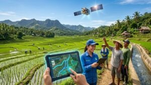
The Philippine government is turning to satellites to solve another problem: making sure farmers have enough water for their crops.
The Philippine Space Agency and the National Irrigation Administration just signed a deal that will run for three years. They want to use images taken from space to keep a close eye on the country’s irrigation systems.
Right now, checking on canals and water levels takes a lot of time because workers have to inspect them on the ground. With satellite data, the government can see where water is going and where it is missing, all from above. This means they can react much faster when area starts running dry.
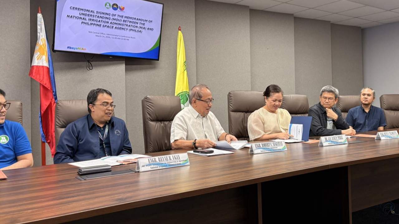
The head of PhilSA, Gay Jane Perez, and the administrator of NIA, Eduardo Eddie Guillen, led the signing. Their main goal is to make water management smarter and less wasteful.
Under the plan, the two agencies will create new digital tools. These tools will help NIA leaders make better decisions using real information. For example, they can spot places where water is being wasted or figure out the best spots to dig new canals.
PhilSA will also teach NIA employees how to read satellite images. That way, the staff can use the data themselves without always asking for outside help.
Why does this matter? The Philippines needs to protect its food supply, especially as climate change brings more unexpected dry spells. By getting live updates from space, the government can make sure rice fields and other crops still get water even when rain is scarce.
This article, PhilSA and NIA will use satellite data to help farmers with irrigation system, was originally published at NoypiGeeks | Philippines Technology News, Reviews and How to's.
Comments
Post a Comment